This site contains links to data sets from the Duck94-CoOP nearshore cross-shore “SPUVT” array of Sonar altimeters (S), Pressure gages (P), bi-directional current meters (UV), and Thermistors (T) deployed from the shoreline to 8 m water depth during August-October 1994.
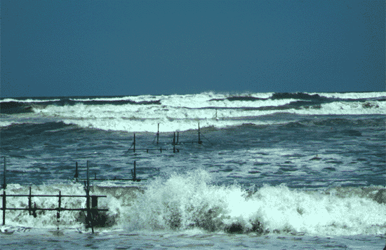
The image below shows the array during a large storm with offshore significant wave heights greater than 4 m.
The SPUVT array (the shoreline in is the foreground) Each instrument frame is approximately 1 m high and 2 m wide, and holds a (S)onar altimeter, (P)ressure sensor, bi-directional(UV) current meter, and a (T)hermistor.

A vertical stack of bi-directional current meters in 8 m water depth.
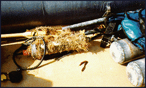
Biological growth (‘cooties’) on a pressure gage after 2 months in the ocean.
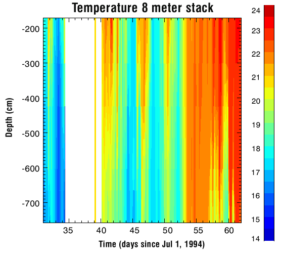
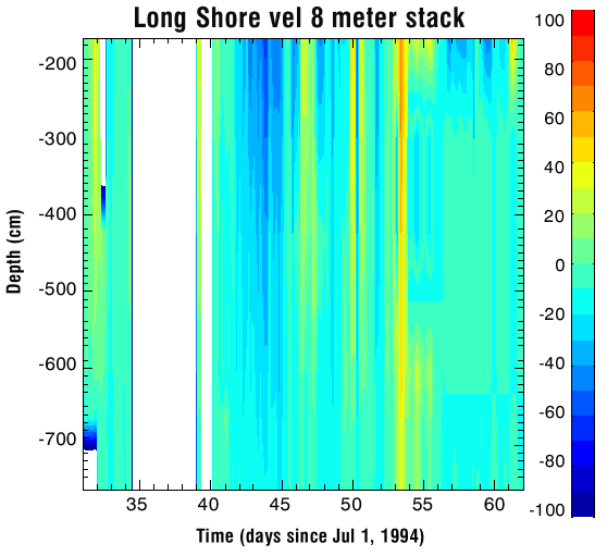
Vertical Distribution of Temperature & Velocity in 8m
Contours of temperature (C) (below left) and longshore velocity (cm/s) ( below right) observed in 8 m water depth between the end of July and September. Note the change in temperature near day 53 associated with strong southerly currents when the wind shifted from upwelling (wind from the south) to downwelling favorable (wind from the north).
Cross-shore Temperature Profile
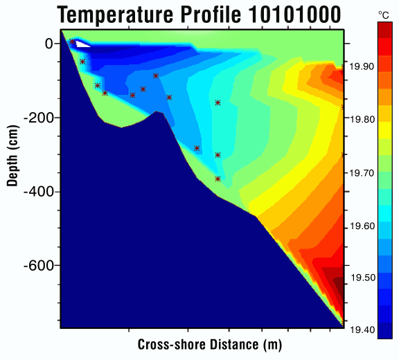
Contours of temperature (3 hr average) on Oct 10, 1000 hrs (corresponding to the other 3-hr average plots). The bottom profile is shown in blue and the thermistors are shown as asterisks. Contours drawn through sparse arrays such as this often contain artifacts owing to the contour routine. Thus, this is a schematic only and should be viewed with caution.
Significant Wave Height
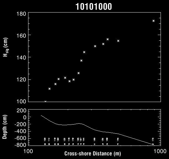
During this storm offshore significant wave heights were about 2 m, and wave breaking was evident across the entire SPUVT array, as shown by the decrease in wave height as the waves propagated shoreward (upper panel). There is a large decrease in wave height near the crest of the sand bar (lower panel is a cross-shore profile) and even quite close to the shoreline the waves were 1 m high.
Velocity Vectors
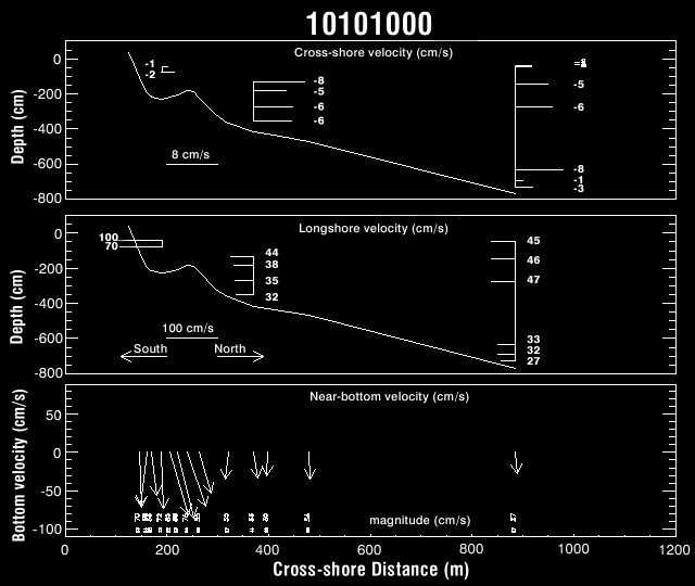
During the storm quasi-steady (3 hr averages) near-bottom horizontal velocities exceeded 100 cm/s. Shown here are offshore (upper panel) and longshore (southerly, middle panel) directed flows observed at the vertical stacks of current meters. The curve is the cross-shore profile determined by the sonar altimeters. Near-bottom velocity vectors are shown in the lower panel.
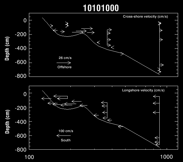
Offshore (upper) and longshore (lower) velocities. The tails of the arrows are drawn at the location of the current meter (vertical distances above the seafloor vary as the bathymetry evolves) and the length of the arrow indicates the current speed. notice the intensified floors near the crest of the sand bar (offshore) and within the trough between bar crest and the beach (longshore).
Download Data
Please fill out the below form to access data files.
"*" indicates required fields