The goal of the SwashX experiment is to make observations of and test models for the cross-shore and vertical structure of wave runup velocities.
The experiment was conducted by Britt Raubenheimer, Steve Elgar, and Bob Guza at Scripps Beach between September 25 and October 16 2000.
The swash zone, the region of the beach that is alternately covered and uncovered by wave runup, is important to erosion, which affects about 70% of the beaches in the United States. Validated models of wave runup velocities would provide spatially dense predictions of swashzone flows that could be used to drive sediment transport models to estimate beach erosion rates.
Accepted for publication by Journal of Geophysical Research – Oceans on May 21, 2002
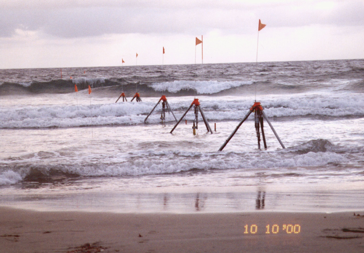
Figure 1. Fluid velocities and pressure were measured along a cross-shore transect spanning the swash and inner surf zones with 5 field ADV (see the Xtree experiment), 2 sets of ADV cable probes stacked vertically at about 2, 5, and 8 cm above the bed, and a PC-ADCP. Pressure sensors, buried just beneath the sand surface, were colocated with each frame.
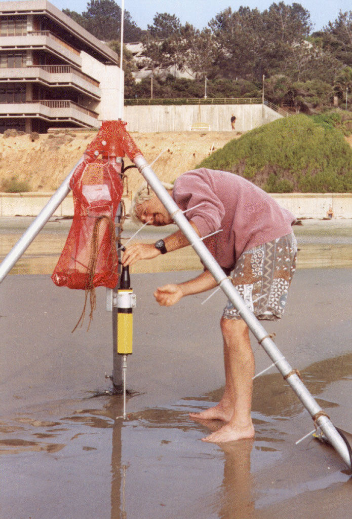
Figure 2. During low tide, Steve Elgar vertically adjusts a velocimeter to maintain approximately constant elevation above the beach surface.
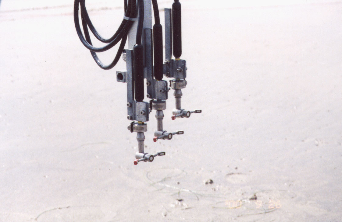
Figure 3. Using the cable probe stacks, swash velocities were observed as close as 0.5 cm above the bed. Preliminary analysis of the vertical velocity structure suggests that a logarithmic wave bottom-boundary-layer may exist in the swash.
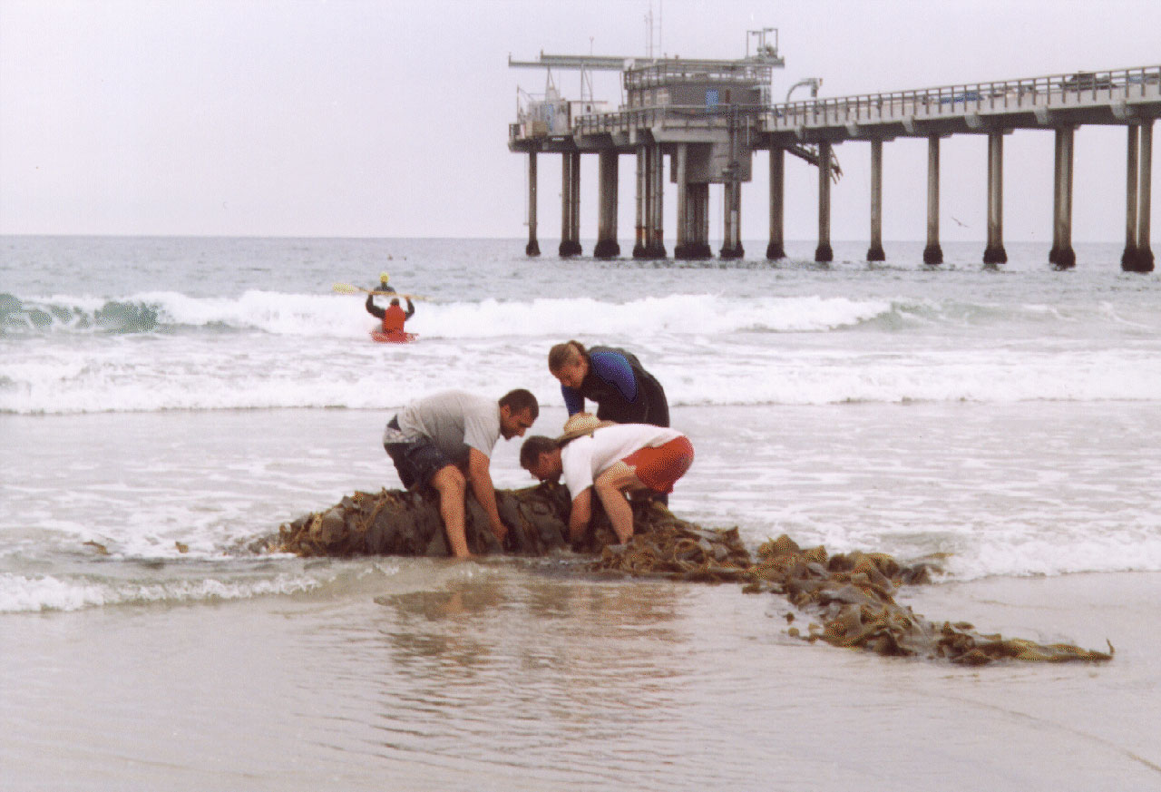
Figure 4. Anil Shukla, Bill Boyd, and Lynn Yarmey move a large tree of macrocystis kelp away from the sensors. Anil and Lynn spent most daylight hours during the 3 week experiment in the surf protecting the sensors from drifting kelp.
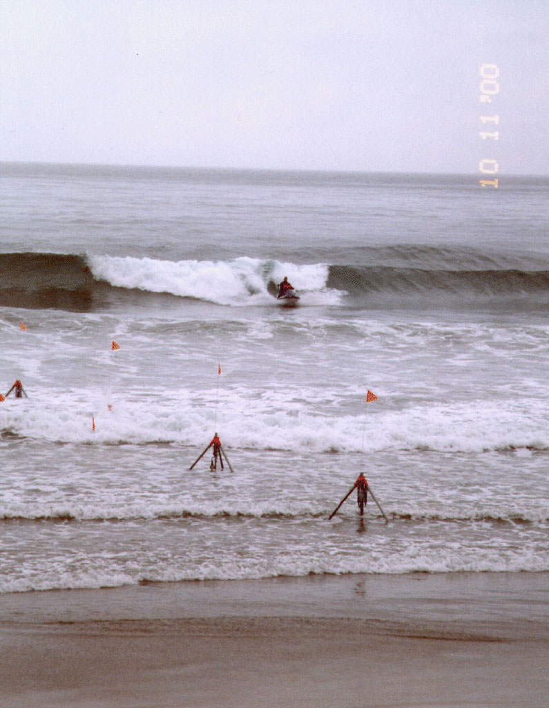
Figure 5. Dennis Darnell drives a wave runner/GPS survey system (see the Truro experiment) through the surf to map the seafloor location.
The instruments were deployed, maintained, and recovered by Bill Boyd, Dennis Darnell, Kimball Milikan, Anil Shukla, Kent Smith, Brian Woodward, and Lynn Yarmey.
Data Download
Please fill out the below form to access data files.
"*" indicates required fields