We are investigating the causes of large nearshore morphological changes using a combination of field observations from the southern shore of Martha’s Vineyard, MA near Katama Inlet (Figure 1) and numerical model simulations. Similar to many coasts, this region evolves on a range of temporal scales, from the rapid erosion and deposition of sediments during few-day-long nor’easters and hurricanes (Figure 1C and D) to the gradual migration of the inlet channel over seasons and years (Figure 2).
Sediment near Katama not only is moved during storms, but also is transported by strong tide-and wave-driven currents (Figure 3), resulting in a mixed wave-and-current energy environment.
-
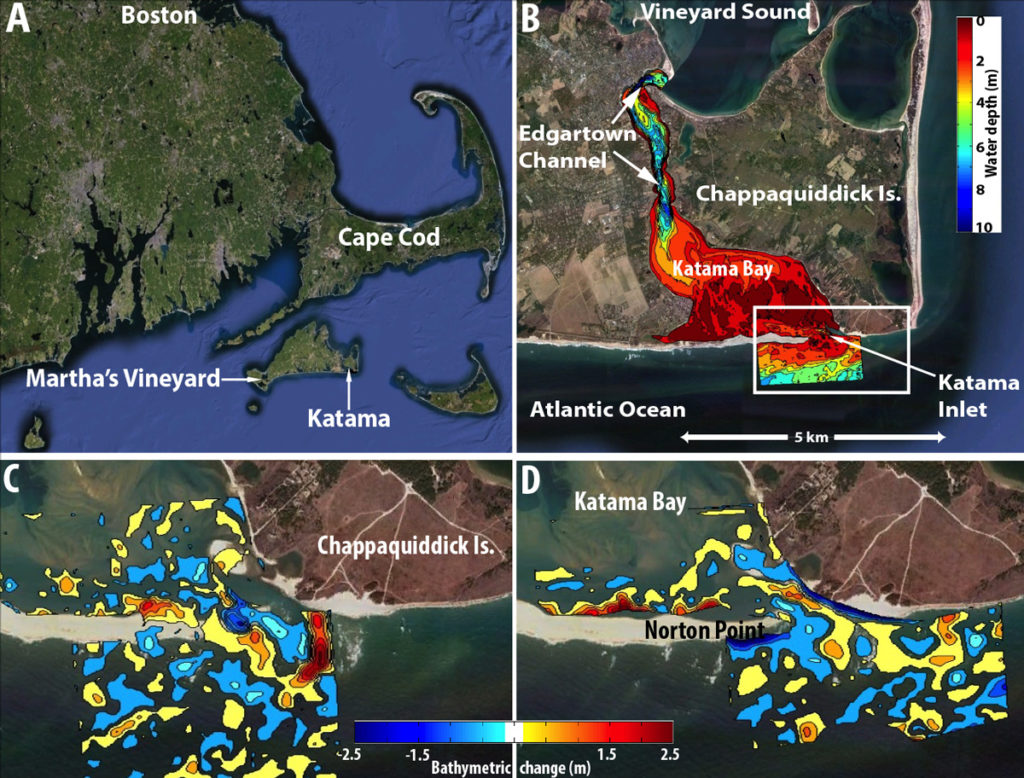
- Figure 1: (A) Southeastern New England showing Katama on the south shore of Martha’s Vineyard. (B) The Katama system. Color contours (scale on right) are water depth (blue is deep, red is shallow) from Jul 2011. Bathymetric change near Katama Inlet (white box in B) caused by hurricanes (C) Irene (Aug 2011) and (D) Sandy (Oct 2012) (color contours, scale on bottom, blue is erosion, red is accretion, only changes > 0.25 m are shown).

-
![Figure 2. The Katama system. Since it breached in 2007 (a), Katama Inlet migrated > 2 km until it closed in Apr 2015 (d). The mouth of the inlet was in roughly the same location from 2012 [not shown, similar to 2014 (c)] until late 2014 (c).](https://pv-lab.org/wp-content/uploads/2018/02/fig2-694x1024.jpg)
- Figure 2. The Katama system. Since it breached in 2007 (a), Katama Inlet migrated > 2 km until it closed in Apr 2015 (d). The mouth of the inlet was in roughly the same location from 2012 [not shown, similar to 2014 (c)] until late 2014 (c).
![Figure 2. The Katama system. Since it breached in 2007 (a), Katama Inlet migrated > 2 km until it closed in Apr 2015 (d). The mouth of the inlet was in roughly the same location from 2012 [not shown, similar to 2014 (c)] until late 2014 (c).](https://pv-lab.org/wp-content/uploads/2018/02/fig2.jpg)
-

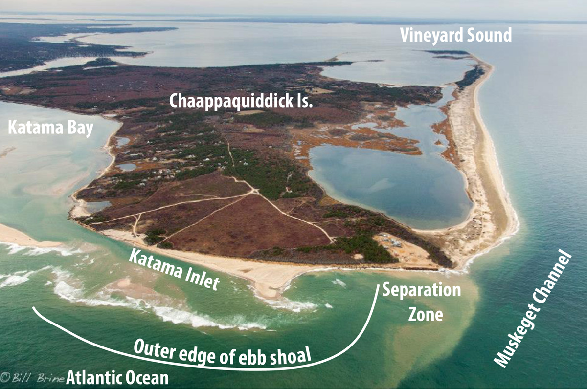
- Figure 3. Chappaquiddick Is. and the southern shore of Martha’s Vineyard (2014) showing Muskeget Channel (tidal flows > 3 m/s) connecting Vineyard Sound and the Atlantic, Katama Inlet (flows ~ 2 m/s), the separation zone where flows are quiescent and sediment (brown water) may settle, and the approximate outer edge of the ebb shoal.
-
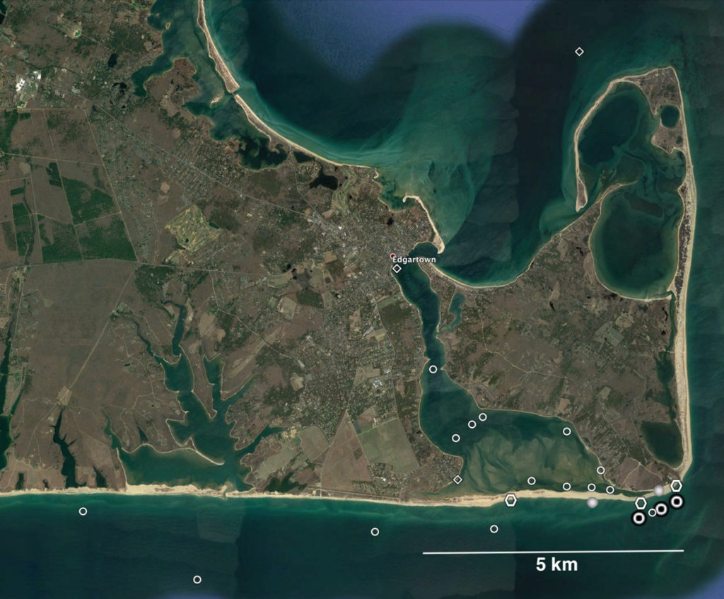
- Figure 4. Google Earth image of Martha’s Vineyard in 2017, with Katama Inlet closed. The symbols are locations of some of the sensors deployed in summer and fall 2011-2015. The colocated sensors measured water levels, tides, waves, and currents.

Results
Some of the results from this project are in:
Orescanin, M., Britt Raubenheimer, Steve Elgar, 2014 Observations of wave effects on inlet circulation, Continental Shelf Research 82, 37-42, doi:10.1016/j.csr.2014.04.010.
Hopkins, Julia, Steve Elgar, and Britt Raubenheimer, 2016 Observations and model simulations of wave-current interaction on the inner shelf, J. Geophysical Research 121, 198-208, doi/ 10.1002/2015JC010788.
Orescanin, M., Steve Elgar, and Britt Raubenheimer, 2016 Changes in bay circulation in an evolving multiple inlet system, Continental Shelf Research 124, 13-22, doi:10.1016/j.csr.2016.05.005.
Hopkins, Julia, Steve Elgar, and Britt Raubenheimer, 2017, Flow separation effects on shoreline evolution, Coastal Engineering 125, 23-27, DOI: 10.1016/j.coastaleng.2017.04.007.
-

- Mara, Sean, Britt, Carrie, and Melissa waiting for the ferry, armed with pressure gages, guarded by Seeing Eye guide dog Whit.
-
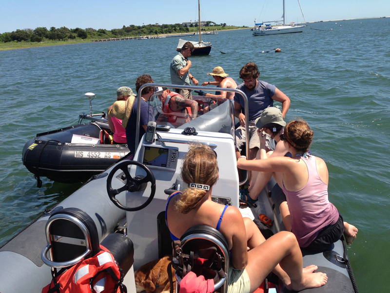
- The PVLAB field crew preparing for boat surveys.
-

- Kohl, Steve, Britt, Lilliana, and Melissa carrying sensors to the field site.
Download Data
Please fill out the below form to access data files.
"*" indicates required fields