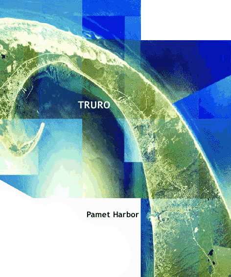
NEARSHORE BATHYMETRY SURVEYS were conducted in Cape Cod Bay, near Truro, MA (a few miles south of Provincetown).
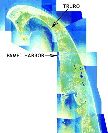
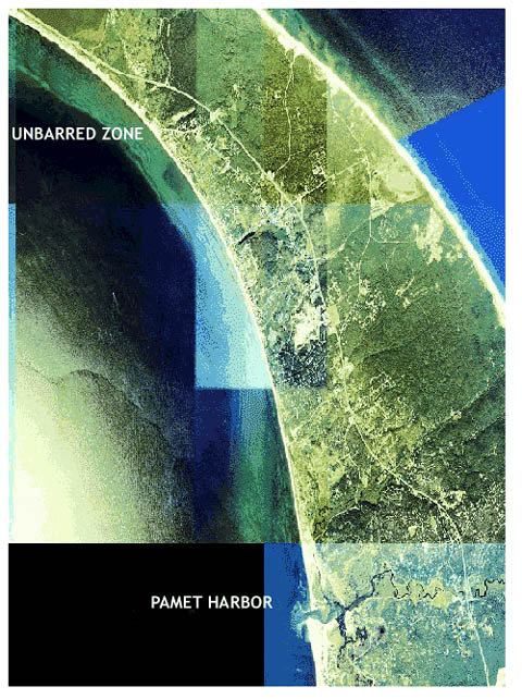
The nearshore morphology between Truro and the Pamet Harbor entrance, 8 km to the south, includes areas with 6-10 shore-parallel sand bars, a section where the sandbars are disappearing (‘unbarred zone’), sets of bifurcating bars, a group of cross-hatched bars, sections with shore-oblique bars, and areas with no bars.
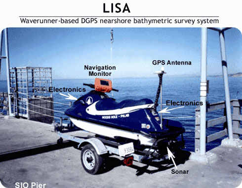
The surveys were performed by Dennis Darnell, Steve Elgar, Laura Moore, Britt Raubenhemier, Anil Shukla and Lynn Yarme. They took place from July 11-13, 2000 using a waverunner-based survey system (LISA) designed and built by a team that includes Tom Lippmann (OSU), Chuck Worley (USGS), Bill Boyd (SIO), Dennis Darnell (SIO), Fred Wright (SIO) and Brian Woodward (SIO).
The waverunner carries a sonar and DGPS. Shoreline (beach) surveys were performed with a 3-wheeled dolly with DGPS.
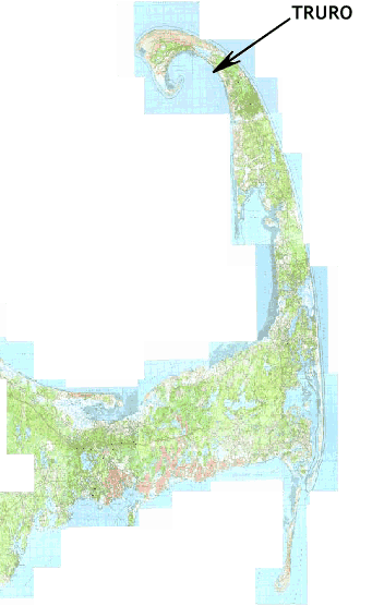
Map of Cape Cod showing Truro near Provincetown.
Reference
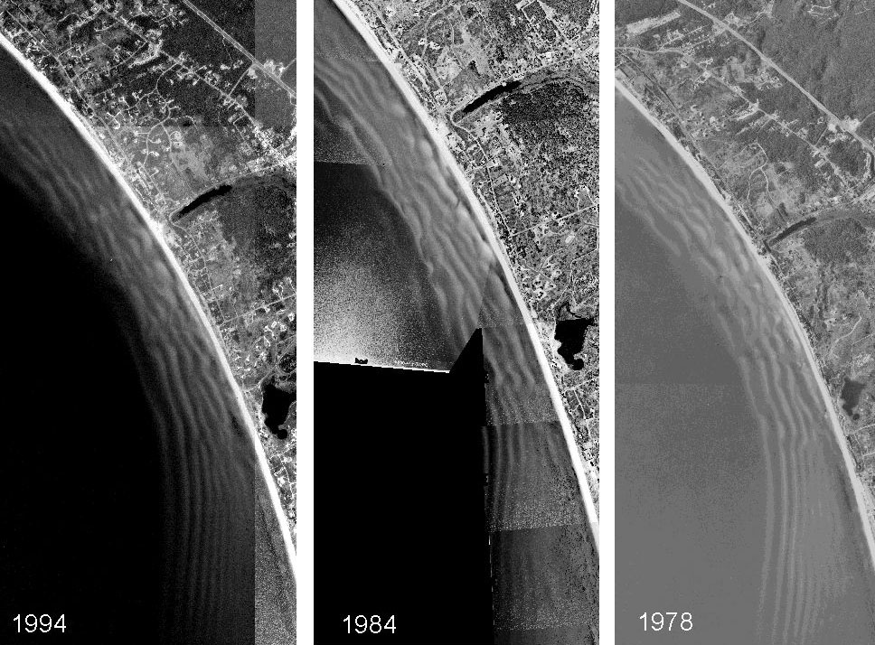
Aerial photos of the shoreline in Cape Cod Bay south of Truro.
The southern part of the unbarred section is in the upper left of the 1994 and 1978 photos, which extend farther north than the 1984 photo.
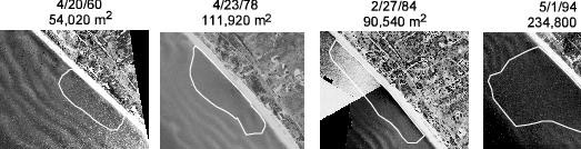
Aerial photographs of the shoreline region near Truro.
The unbarred section is delineated by the white curve near the center of each photograph. Dates (month/day/year) and approximate area of the unbarred section are listed above each photograph, and suggest the area with no sandbars is growing.
Moore, Sullivan, & Aubrey, Interannual evolution of multiple longshore sand bars, Truro, MA, J. Geophys. Res., submitted, 2000.
Area Maps
The surveys were performed between the Pamet Harbor entrance and Truro.
When glaciers retreated, a giant pile of sand was left behind. Wind and waves cause constant changes to subaerial and subaqueous morphology. Sand bars extend along the Atlantic coast of Cape Cod, parabolic sand dunes extend for several miles along the Cape from above Truro toward Provincetown (located near the upper-left of the photo), and different sand bar configurations extend along the coast in Cape Cod Bay.
-

- Aerial photo showing the northern part of the outer Cape.
-

- Closeup of the northern part of the outer Cape.
-

- Closeup of the surveyed shoreline in Cape Cod Bay
The Gear
The waverunner contains a sonar to detect the distance from the hull to the seafloor and a DGPS to determine x-y-z position. Tilts are measured with a KVH gyro to compensate for movement of the antenna (eg, in big waves). Real-time kinematic GPS corrections are radioed from the base station (on the beach) to an onboard computer to allow the operator to navigate accurately with a map displayed on the monitor (orange) on the handle bars.
Horizontal and vertical GPS coordinates obtained at 1 Hz are interpolated to accomodate the up-to 25 Hz sonar data. Electronics and onboard computers are housed in every possible little space on the waverunner. Postprocessing filters bad sonar returns and inaccurate GPS cordinates. Performance is excellent (> 95% data return) in quiescent conditions (eg, Cape Cod Bay, no surf zone).
-
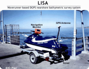
- LISA, the waverunner-based differential GPS nearshore bathymetric survey system.
-

- The DGPS base station (round antenna) and real-time kinematic correction transmitter (long antenna) on the beach, near Truro.

-
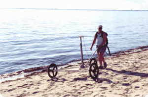
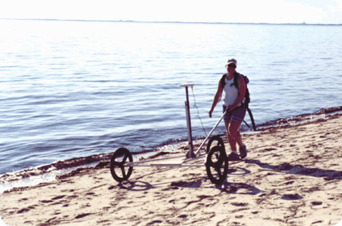
- Dolly, the beach version of LISA. Lynn Yarmey is carrying the GPS rover in a backpack while she pushes the 3-wheeled Dolly along pre-marked cross-shore transects to obtain surveys of the shoreline above mean sea level.
The Results
-

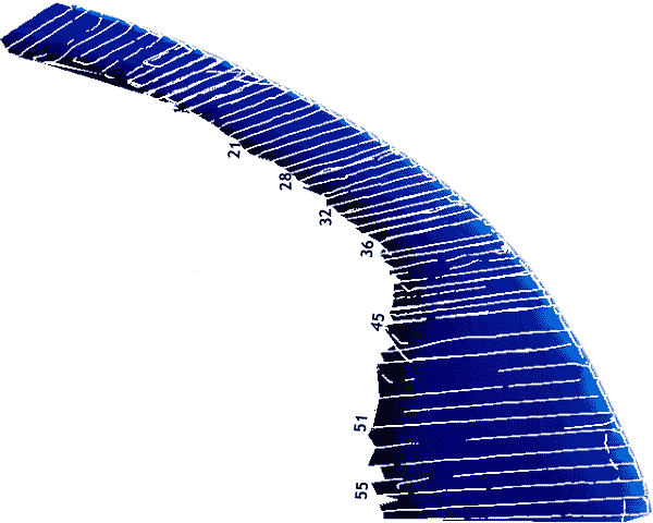
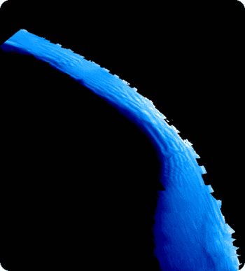
- Figure 1. Tracks surveyed by LISA and Dolly near Truro. The blue area primarily is under water and was surveyed by LISA. The lightest color blue is the beach above mean sea level, and was surveyed by Dolly. Gaps in the cross-shore tracks correspond to missing data.
-

- Figure 2. Nearshore bathymetry obtained with LISA. Only water depths between about 2 and 6 m below mean sea level are shown to increase the vertical resolution of the color scale. Dark blue is deeper water, light blue is shallower water. The features are described in the next figure.
-

- Figure 3. Annotated version of the survey near Truro.
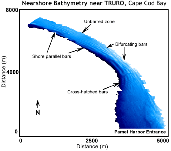
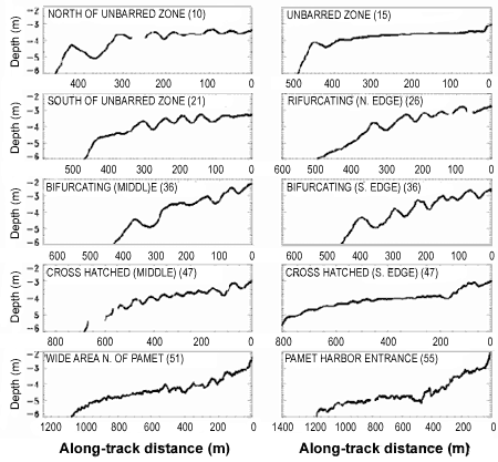
Figure 4. Depth versus along-track distance.
The nearshore morphology (Figure 3) includes areas with 6-10 shore parallel bars, separated by a growing (over 40 years) zone with no bars (Unbarred zone). To the south are bifurcating bars, and a really wild set of cross-hatched bars. Farther south, just north of the Pamet Harbor entrance, the shallow nearshore area extends farther offshore, and there are fewer or more subtle bars.
Cross-shore depth profiles (along the LISA survey tracks) for ten locations along the shoreline (Figure 4). Each track is labeled with a description and a track number in parantheses. The labels (most) and the track numbers are also shown on the plot to the right. Depth units are meters relative to mean sea level. Along-track distance ranges from onshore (0) to offshore (scale changes). level.